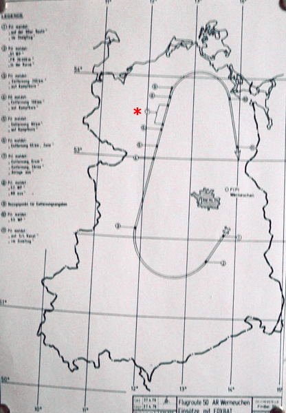
L'itinéraire ou plan de vol n°50 de Werneuchen.
Le point n°7 (astérisque rouge) indiquait les points de larguage simulés annoncés par les termes grom (tonnerre) ou sbros (larguage).
Téléchargez la route n°50 pour Google Earth >ici<
Matériel fourni par >Manfred Bischoff<
The flight route n°50 for Werneuchen.
Point n°7 (red asterisc) indicated the simulated drop points that were annouced with the terms grom (thunder) or sbros (drop).
Download route n°50 for Google Earth >here<
Material provided by >Manfred Bischoff<